Publisher:
Bonnie King
CONTACT:
Newsroom@Salem-news.com
Advertising:
Adsales@Salem-news.com

~Truth~
~Justice~
~Peace~
TJP
Sep-01-2006 13:18

 TweetFollow @OregonNews
Forecast: Oregon in For a Warmer Winter, But Don’t Discount Big Portland Snowstorm
Salem-News.comSkiers should expect a decent year, but nowhere near as good as last year.
 Cross pattern in the Salem sky Thursday from jets Photo by: Tim King |
(CORVALLIS) -  For most of Oregon, the fall and winter weather this year should be comparatively warmer and maybe a touch wetter than usual – but with one big caveat.
Don’t discount the possibility of a big snowstorm – at least, in Portland.
George Taylor, the state climatologist employed at Oregon State University, released his annual fall and winter forecast on Monday, which is based on analyzing numerous oceanic and atmospheric conditions and comparing them to similar years in the past. These “analog” years often offer the best avenue for predictions, Taylor said.
 Oregon '05 by Tim King |
 “Although this is just a guess, I don’t think we’ll see widespread snow throughout the low elevations, including the Willamette Valley and the rest of Oregon,” Taylor added. “But it wouldn’t surprise me to see at least one snow event of four or more inches in Portland, especially close to the gorge. Portland could have a big snow year.”
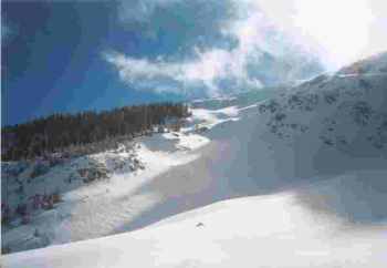
Taylor said mountain snows usually are a bit deeper during these ENSO-neutral (El Niño/Southern Oscillation) years – especially in southern Oregon.
“For skiers, this should be a decent year,” he pointed out. “Not as good as last year, but decent.”
In addition to El Niño or La Niña conditions, Taylor uses a number of other factors in developing analog years including the overall warm-dry or cool-wet cycles – known as the multi-decadal phase – that occur on a 20- to 25-year basis. He also uses sea surface temperatures, the solar cycle, regional climate patterns and even hurricanes.
 Years ago, we noticed a strong correlation between the number of Atlantic hurricanes and Pacific Northwest climate during the winter,” Taylor said. “Last year’s very busy hurricane season followed by an extremely active winter in the Northwest is consistent with that pattern. The 2006 hurricane season – so far – has been unremarkable, suggesting we might have a much less active winter.”
However, there have been some extreme events in analog years for the 2006-07 fall and winter seasons.
In 1951-52, for example, Oregon was struck by a major wind storm in November, two more large windstorms in December, a tornado in December near Eugene, and a large snowstorm in March.
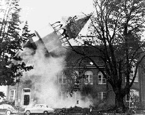
 The Columbus Day Storm brought major damage |
Twenty years ago, Oregon saw record setting rainfall in November of 1986, followed by a strong coastal windstorm in January, and flooding in northwest Oregon in February.
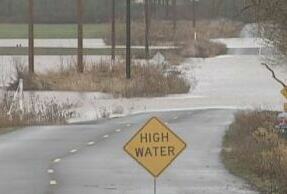
Ten years ago, during another analog year, Oregon was struck by extreme floods in November, and more flooding in late December and early January. An ice storm hit Portland in December of 1996.
 Oregon Capitol snow in 2003 |
“As you can see,” Taylor said, “predicting what will happen involves a bit of guesswork. There is the potential for extreme events, so windstorms and flooding are possibilities. So is snow, but Portland still seems the most likely possibility.”
Taylor also has produced regional forecasts for Oregon. They include:
Oregon Coast: Above-average fall (October-December) and winter (January-March) Temperatures; average fall and winter precipitation.
Northwest Interior: Average fall temperatures and above-average winter temperatures; above-average fall precipitation and average winter precipitation.
Southwest Interior: Average fall temperatures and above-average winter temperatures; above-average fall precipitation and average winter precipitation.
N. Central/Northeast: Average fall temperatures and above-average winter temperatures; average fall and winter precipitation.
 S. Central/Southeast: Average fall temperatures and above-average winter temperatures; average fall and winter precipitation.
“Overall,” Taylor said, “it looks like we’ll see warmer-than-average temperatures in Oregon and average to above-average precipitation. Remember, that this is still a guess based on conditions. Last year was probably our most successful forecast ever, so we’ll see if we can make it two in a row.”
The Oregon Climate Service at OSU has Taylor’s entire forecast, as well as charts, graphics and links to other valuable climate sites. The Oregon Climate Service can be linked at: www.ocs.oregonstate.edu
Articles for August 31, 2006 | Articles for September 1, 2006 | Articles for September 2, 2006
Quick Links
DINING
Willamette UniversityGoudy Commons Cafe
Dine on the Queen
Willamette Queen Sternwheeler
MUST SEE SALEM
Oregon Capitol ToursCapitol History Gateway
Willamette River Ride
Willamette Queen Sternwheeler
Historic Home Tours:
Deepwood Museum
The Bush House
Gaiety Hollow Garden
AUCTIONS - APPRAISALS
Auction Masters & AppraisalsCONSTRUCTION SERVICES
Roofing and ContractingSheridan, Ore.
ONLINE SHOPPING
Special Occasion DressesAdvertise with Salem-News
Contact:AdSales@Salem-News.com


googlec507860f6901db00.html

Terms of Service | Privacy Policy
All comments and messages are approved by people and self promotional links or unacceptable comments are denied.
[Return to Top]
©2026 Salem-News.com. All opinions expressed in this article are those of the author and do not necessarily reflect those of Salem-News.com.