Publisher:
Bonnie King
CONTACT:
Newsroom@Salem-news.com
Advertising:
Adsales@Salem-news.com

~Truth~
~Justice~
~Peace~
TJP
Mar-13-2011 13:18

 TweetFollow @OregonNews
The Revenge of the Supermoon
JD Adams Salem-News.comWith the ongoing nuclear reactor emergency in Japan because of the earthquake, we may have radioactive fallout heading for Oregon in the days ahead. It shall be an interesting week indeed.
 Courtesy: Suchith KC's blog |
(SALEM, Ore.) - Our lives are measured by the cadence of lunar clockwork as the Earth-Moon system spins in gravity's embrace. The primordial influence of the Moon has synchronized life itself, driving our biorhythms and reproductive cycles.
Marching across the night sky, it's pale luminance has inspired countless works of art, poetry, and music. Since the dawn of humankind we have heard the call of the coyote while the clouds have stirred the muted palette of moonrise.
We are likewise locked into the physical lunar manifestations on planet Earth, and deep within we have known the pull of the tides. The extremes of the Moon's orbit exert powerful pressure upon the delicate equilibrium of the Earth, and the tectonic plates that ride atop it's molten core are forced to react.
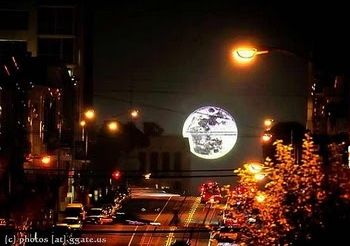
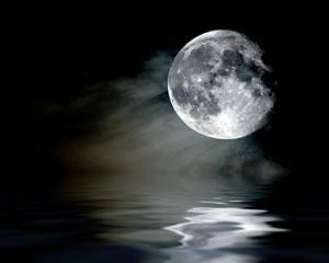
The elliptical nature of the Moon's orbit will place it closer to the Earth on March 19, 2011 than it has been in 18 years, an event known as a lunar perigee, when it will be be approximately 14,000 miles closer than normal.
Astrologer Richard Nolle has popularized the term 'Supermoon' to denote a window of time when a full Moon is over 90% of the minimum point of eccentricity, warning of possible earthquakes, extreme tides, and volcanism during a period from March 16th through the 22nd. According to Nolle, "If you look at the USGS website where they have all the significant earthquakes of 2011, you will find that 72.7% of them fall in the risk windows on my website. The Christchurch earthquake happened on the last day of a supermoon window.
 |
The Haiti earthquake even happened in one of the time windows in my 2010 forecast -- which was published the year before." Nolle's exact forecast is as follows: "A surge in extreme tides along the coasts, a rash of moderate-to-severe seismic activity (including magnitude 5+ earthquakes, tsunami and volcanic eruptions), and most especially in this case a dramatic spike in powerful storms with heavy precipitation, damaging winds and extreme electrical activity. Floods are a big part of the picture in this case, although some of these will be dry electrical storms that spark fast-spreading wildfires."
An emeritus professor for the Astronomy and Planetary Science Department at Caltech University named Peter Goldreich has downplayed the Supermoon phenomenon, but he admits that seismic equipment Apollo astronauts left on the Moon has detected quakes near the lunar perigee. The Moon is the largest natural satellite in the Solar System relative to the size of the Earth, and has a diameter a quarter that of Earth. If moonquakes could occur, given the close gravitational coupling of the Earth-Moon system, and the interaction of angular momentum, it's certainly possible that stresses in the Earth's crust resulting from the Supermoon phenomenon could be unleashed in the form of tectonic disasters.
Since the recent 8.9 Japan earthquake and tsunami of March 11, 2011, it begs the question of whether it could have been related to the Supermoon.
Despite the contrary opinions of some scientists, there's no way to definitively say it wasn't. Scientists can't yet predict earthquakes, much as they would like to. Let's review some historical data: The last extreme Supermoon happened on January 10th, 2005, 15 days after the Indonesia earthquake that registered 9.0. And don't forget Hurricane Katrina, which inundated New Orleans 10 days after a Supermoon. The there was the New England hurricane of 1938, the Hunter Valley floods of 1955, and Cyclone Tracy in 1974, all associated with the cycle of the Supermoon. An unusual swarm of earthquakes was noted off the coast of Oregon on or around March 8th, and as of March 12th, Japan continues to experience severe aftershocks that are centered within the island.
Periodic fluctuations in the orbit of the Moon have made this Supermoon event particularly intense. With the ongoing nuclear reactor emergency in Japan because of the earthquake, we may have radioactive fallout heading for Oregon in the days ahead. It shall be an interesting week indeed.
Sources:
http://www.astropro.com/
http://en.wikipedia.org/wiki/Moon
http://en.wikipedia.org/wiki/
http://www.foxnews.com/
_______________________________________________________________________
 J. D. Adams was born in Salem, Oregon, a descendant of Oregon Trail pioneer William Lysander Adams. As a wilderness explorer, photographer, and writer, he sustains a kinship with the spirit of the Oregon country. JD inhabits Oregon's Silicon Forest as an electronics professional with degrees in Electronics Engineering Technology and Microelectronics.
He maintains a Web presence with a signature presentation in genres including travel, history, and technology.
You can write to Jim Adams at this email address: j1mcm0s@earthlink.net
Also, visit Jim's Website: home.earthlink.net/~j1mcm0s/
Articles for March 12, 2011 | Articles for March 13, 2011 | Articles for March 14, 2011


Salem-News.com:


Terms of Service | Privacy Policy
All comments and messages are approved by people and self promotional links or unacceptable comments are denied.
JDA March 21, 2011 11:48 pm (Pacific time)
Here's what the supermoon did:
March 19th 2011 earthquakes
M 5.2 2011/03/19 02:33 Depth 31.8 km NIAS REGION, INDONESIA
M 4.9 2011/03/19 05:23 Depth 63.5 km VANUATU
M 4.6 2011/03/19 00:36 Depth 68.9 km MINDANAO, PHILIPPINES
M 5.9 2011/03/19 01:22 Depth 9.2 km OFF THE EAST COAST OF HONSHU, JAPAN
Magnitude 7.6 - TONGA REGION 2009 March 19 18:17:40 UTC
Magnitude 5.0 – ETHIOPIA 2011 March 19 20:08:11 UTC
March 18th, 2011 earthquakes
Magnitude 4.6 - ANDREANOF ISLANDS, ALEUTIAN IS., ALASKA 2011 March 18 09:54:11 UTC
M 4.5 2011/03/18 09:36 Depth 10.0 km CENTRAL KAZAKHSTAN / KYRGYZSTAN
M 4.5 2011/03/18 01:44 Depth 10.0 km GULF OF CALIFORNIA
M 5.0 2011/03/18 13:38 Depth 25.1 km OFF THE EAST COAST OF HONSHU, JAPAN
M 5.0 2011/03/18 12:17 Depth 31.7 km NEAR THE EAST COAST OF HONSHU, JAPAN
M 5.3 2011/03/18 08:01 Depth 24.2 km NEAR THE EAST COAST OF HONSHU, JAPAN
M 5.5 2011/03/18 03:23 Depth 19.0 km OFF THE EAST COAST OF HONSHU, JAPAN
M 5.2 2011/03/18 02:47 Depth 45.2 km NEAR THE EAST COAST OF HONSHU, JAPAN
M 5.4 2011/03/18 00:41 Depth 45.8 km NEAR THE EAST COAST OF HONSHU, JAPAN
March 20th, 2011 earthquakes
Magnitude 5.5 - TAIWAN REGION 2011 March 20 08:00:50 UTC
M 5.0 2011/03/20 14:05 Depth 9.5 km NEAR NORTH COAST OF NEW GUINEA, P.N.G.
March 21, 2011 at 12:05:00 AM at epicenter
Harmless earthquake more than 100 km out of the coast.
194 km (120 miles) N (360°) from Madang, New Guinea, PNG
Satellite map of the greater epicenter area
M 6.1 2011/03/20 12:03 Depth 53.1 km NEAR THE EAST COAST OF HONSHU, JAPAN
09:03:48 PM at epicenter
Epicenter only 10 km from Funakoshi Bay ! JMA intensity so far is 4 (on a scale of 7)
92 km (57 miles) ESE (115°) from Morioka, Honshu, Japan
Satellite map of the greater epicenter area
M 4.5 2011/03/20 08:47 Depth 10.9 km SOUTH ISLAND OF NEW ZEALAND
08:47:39 PM at epicenter
UPDATE 13:22 UTC : Three aftershocks, one a strong 5.1 magnitude, rattled quake-weary residents of Christchurch late tonight. A Civil Defence spokeswoman told NZPA there were no reports of damage, but police and Civil Defence staff were checking building in central Christchurch. Source : stuff.co.nz
Moderate aftershock felt as a MMI IV in the city.
14 km (8 miles) E of Christchurch, New Zealand
Satellite map of the greater epicenter area
M 6.0 2011/03/20 08:26 Depth 36.6 km BABUYAN ISLANDS REGION, PHILIPPINES
04:26:11 PM at epicenter
Please read our in-depth report about this earthquake - Click here
NO damaging earthquake near the Babuyan Islands on the Philippines
Epicenter approx. 15 km from Fuga Island, which has a population of 1,786 people on 312 households
On of the theoretical earthquake models results in NO fatalities OR Injured. @ earthquake-report.com, we do not share this opinion, but we hope that they are right.
GDACS published a GREEN earthquake alert for this earthquake = very limited chance on damage and/or injuries. @ earthquake-report.com, we do not share this opinion, but we hope that they are right.
111 km (69 miles) NE (39°) from Laoag, Luzon, Philippines
Satellite map of the greater epicenter area
M 5.5 2011/03/20 08:00 Depth 17.3 km TAIWAN REGION
04:00:50 PM at epicenter
UPDATE 10:59 UTC – EMSC testimony out of Taiwan (130 km from the epicenter)
There was a definite second moderate swaying on the build at approximately 16:30.
Shallow strong earthquake approx. 50 km out of the coast of Southern Taiwan.
We expect No or minor damage as the earthquakes epicenter (if the epicenter location will be confirmed) is out in the sea.
44 km (28 miles) SE (144°) from T’ai-tung (Taitung), Taiwan
At approx. the same distance as Taitung are the cities of Dawu, Taimali and the island of Lyudao.
Satellite map of the greater epicenter area
M 4.6 2011/03/20 00:10 Depth 10.1 km SOUTH ISLAND OF NEW ZEALAND
12:10:22 PM at epicenter
Shallow earthquake in the lake area near Lake Ohau and Lake Pukaku. Close to highway 8 near Quailburn and Glenbrook.
125 km (77 miles) NE of Queenstown, New Zealand
Satellite map of the greater epicenter area
Daily summary of deep moderate or weak quakes only faintly felt by people living above it
M 4.9 2011/03/20 13:46 Depth 256.4 km SANTA CRUZ ISLANDS
M 4.7 2011/03/20 13:39 Depth 111.4 km COLOMBIA
M 4.8 2011/03/20 01:20 Depth 64.6 km JAVA, INDONESIA
M 5.3 2011/03/20 11:47 Depth 138.6 km TONGA
Japan, Honshu : aftershocks of M5 or greater
M 5.3 2011/03/20 07:56 Depth 28.9 km NEAR THE EAST COAST OF HONSHU, JAPAN
116 km (72 miles) E of Mito, Honshu, Japan
M 5.2 2011/03/20 05:58 Depth 27.3 km NEAR THE EAST COAST OF HONSHU, JAPAN
Approx. 50 km from Choshi and 119 km (73 miles) ESE of TOKYO, Japan- Max. JMA 3
M 5.4 2011/03/20 05:55 Depth 51.0 km NEAR THE EAST COAST OF HONSHU, JAPAN
Approx. 35 km from Soma and 72 km (44 miles) SE of Sendai, Honshu, Japan- Max. JMA 3
M 5.5 2011/03/20 01:30 Depth 22.8 km NEAR THE EAST COAST OF HONSHU, JAPAN
Only 28 km (17 miles) ESE of Iwaki, Honshu, Japan- Max. JMA 4
M 5.0 2011/03/20 01:24 Depth 31.3 km NEAR THE EAST COAST OF HONSHU, JAPAN
Approx. 60 km out of the Minamisoma coast- Max. JMA 4
M 5.2 2011/03/20 01:09 Depth 36.9 km NEAR THE EAST COAST OF HONSHU, JAPAN
Only 40 km out of the Kamaichi coast- Max. JMA 4
See http://earthquake-report.com/2011/03/20/earthquakes-list-march-20-2011/
JDA March 14, 2011 4:32 pm (Pacific time)
I turned in an article that is much more relevent to the nuclear situation and debate on the night of March 13th, but it hasn't shown up yet. Remember you would have heard it here first.
NadePaulKuciGravMcKi March 14, 2011 11:14 am (Pacific time)
Microscopic plutonium fallout inhalation. 10 years of constant lies from US government, 10 years of constant lies from controlled media
Dont worry bout my name March 14, 2011 5:45 am (Pacific time)
i have herd that the supermoon effects is giving us signs saying that the world will end in 2012
GP March 13, 2011 1:22 pm (Pacific time)
Do let people know, stock up on iodine and start taking it, kids should stay in when cloud comes over, miso and kelp help protect, cesium comes down with rain. The soil is contaminated for half life of 28 years and crops that stay in ground a long time contain more cesium. Rye has the least cesium of all the grains, spuds and carrots, beets and so forth more than lettuce and tomatoes...like that. Scientist in Oregon did the studies of cesium uptake in and around Kiev and Chernobyl. Million people there died as a result of accident. Can't remember the guys name but Eddie and I went to see him in 1994 when he made the maps and he told us what to eat in Poland to be safer. Milk and cheese and meat are the worst. Buy some powdered milk now for use in the next year. Info is there if we can get it to folks. Not much lead time. Cloud only takes 6 days to get across the Pacific and a few weeks to get around the entire planet. This is terrible news. After Hiroshima they found miso drinkers were somehow protected.
Anonymous001 March 13, 2011 7:34 pm (Pacific time)
It has been confirmed that the Fukushima Incident is indeed a meltdown. Just in from Stratfor:
"Japan’s Nuclear and Industrial Safety Agency (NISA) said March 12 that the explosion at the Fukushima Daiichi No. 1 nuclear plant could only have been caused by a meltdown of the reactor core, Japanese daily Nikkei reported. This statement seemed somewhat at odds with Japanese Chief Cabinet Secretary Yukio Edano’s comments earlier March 12, in which he said “the walls of the building containing the reactor were destroyed, meaning that the metal container encasing the reactor did not explode.”
NISA’s statement is significant because it is the government agency that reports to the Agency for Natural Resources and Energy within the Ministry of Economy, Trade and Industry. NISA works in conjunction with the Atomic Energy Commission. Its role is to provide oversight to the industry and is responsible for signing off construction of new plants, among other things. It has been criticized for approving nuclear plants on geological fault lines and for an alleged conflict of interest in regulating the nuclear sector. It was NISA that issued the order for the opening of the valve to release pressure — and thus allegedly some radiation — from the Fukushima power plant."
The following link shows the fallout map if, indeed, there was a substantial release of nuclear material:
http://img847.imageshack.us/img847/438/fallout.jpg
Anonymous001 March 13, 2011 6:42 pm (Pacific time)
Real-time Map of Radioactivity Measurements in the U.S. http://www.radiationnetwork.com/RadiationNetwork.htm
[Return to Top]©2026 Salem-News.com. All opinions expressed in this article are those of the author and do not necessarily reflect those of Salem-News.com.