Publisher:
Bonnie King
CONTACT:
Newsroom@Salem-news.com
Advertising:
Adsales@Salem-news.com

~Truth~
~Justice~
~Peace~
TJP
Jan-23-2009 14:21

 TweetFollow @OregonNews
'Tracking Oregon's Boundaries' Depicts Pacific Northwest between 1802-1861
Salem-News.comMap exhibit will be displayed at capitol as part of the state's 150th birthday celebration
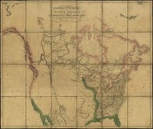
 Early Oregon map Courtesy: University of Oregon |
(EUGENE, Ore.) - The period between 1802 and 1861 was a time of exploration and settlement in the Pacific Northwest, specifically in the area that would become Oregon in 1859. An exhibition of rare maps from this time period will be displayed through the month of February in the capitol building in Salem as part of the state's sesquicentennial celebration.
The exhibit, "Tracking Oregon's Boundaries: Maps from 1802 to 1861," highlights more than 60 years of the changing topography, geography and political boundaries of the region. Many of the maps were commissioned by the U.S. government and were created by the best cartographers of the time. One is from the same printing of the map used to plan the Lewis and Clark exploration, with the area from the Mississippi River to the Pacific Ocean virtually blank.
The show, which is sponsored by the University of Oregon, features high-resolution digital prints of the maps from the collection of Dr. Jim Walker. The show will also include interactive features, such as an origin of names activity and information about mapmaking and the biographies of some of the cartographers.
"These maps are works of art that illustrate Oregon's history in a microcosm," said Jon Erlandson, executive director, UO Museum of Natural & Cultural History. "We are excited to be able to share these pieces of Oregon's past and help celebrate the state's birthday."
The maps take the viewers through visual timeline of the history of Oregon as it became a state. Map on display include:
- Charles Fremont's Oregon Trail route
- The first use of "Oregon Territory," well before there was an official territory
- A map by Washington Hood drawn to accompany the U.S. Senate report promoting a bill to authorize the president to occupy the Oregon Territory
- A 1859 document that is believed to be the first printed map of Oregon as a state
The University of Oregon is a proud participant in Oregon 150—the sesquicentennial celebration of Oregon’s admission to the Union in 1859. The mission of Oregon 150 is to inspire people across the state to remember, experience and celebrate Oregon and, together, create a robust and sustainable future. For more information: oregon150.uoregon.edu.
Links: Museum of Natural and Cultural History, natural-history.uoregon.edu; UO Oregon 150, Oregon150.uoregon.edu
Source: Patricia Krier/University of Oregon
Articles for January 22, 2009 | Articles for January 23, 2009 | Articles for January 24, 2009


Salem-News.com:

Quick Links
DINING
Willamette UniversityGoudy Commons Cafe
Dine on the Queen
Willamette Queen Sternwheeler
MUST SEE SALEM
Oregon Capitol ToursCapitol History Gateway
Willamette River Ride
Willamette Queen Sternwheeler
Historic Home Tours:
Deepwood Museum
The Bush House
Gaiety Hollow Garden
AUCTIONS - APPRAISALS
Auction Masters & AppraisalsCONSTRUCTION SERVICES
Roofing and ContractingSheridan, Ore.
ONLINE SHOPPING
Special Occasion DressesAdvertise with Salem-News
Contact:AdSales@Salem-News.com

Terms of Service | Privacy Policy
All comments and messages are approved by people and self promotional links or unacceptable comments are denied.
[Return to Top]
©2026 Salem-News.com. All opinions expressed in this article are those of the author and do not necessarily reflect those of Salem-News.com.