Publisher:
Bonnie King
CONTACT:
Newsroom@Salem-news.com
Advertising:
Adsales@Salem-news.com

~Truth~
~Justice~
~Peace~
TJP
Feb-22-2017 18:36

 TweetFollow @OregonNews
Snow Levels Drop and Flood Warnings Continue for NW Oregon
Salem-News.com WeatherA late winter storm will bring more rain and maybe even some snow.
 |
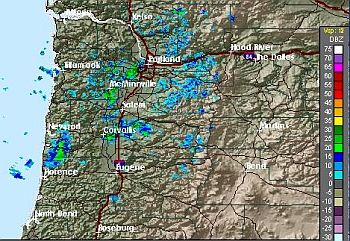
(SALEM, Ore.) - The Central and North Oregon Coast, the Coast Range and the Willamette Valley may experience low snow levels through early next week, according to the National Weather Service.
While the threat of snow is eminent, an active Flood Watch continues for two rivers, the Pudding River at Aurora and the Tualatin River at Farmington.
A cool and unstable air mass will linger over the region for the next several days. Low elevation temperatures will hover in the lower to middle 30s each night.
Most accumulating snow will remain around 1,000 feet or higher. However, some showers may bring visible snow down to sea level for most of the next several days.
The best chance for brief low level accumulations will be during the overnight and early daylight hours when ground temperatures are coldest. Any accumulations will be short-lived and should melt within a couple hours.
Above 1,000 feet, 1 to 2 inches of accumulation are possible each day. This would impact many Coast Range passes along with the Cascade Foothills and the highest terrain of the Portland and Vancouver Metro area.
Friday appears to have the best potential for accumulating snow as a compact upper low will slide south along the coast centered about 200 miles offshore.
Weather models are currently keeping most precipitation along the coast range and westward. However, a couple are hinting at potential for a brief snow band to form over the north Willamette Valley and Lower Columbia River area, including the Metro area around the time of the morning commute.
The range of possible accumulation amounts at elevations close to sea level are mostly less than a half inch, however, one model indicates 1 to 2 inches ending around 10 am Friday.
Those traveling over the next several days should stay up to date with the latest forecasts and especially for Friday as details evolve.
According to the Willamette Tributaries Bulletin, the Flood Warning continues for two rivers in Oregon, the Pudding River at Aurora affecting Clackamas and Marion Counties, and the Tualatin River at Farmington affecting Washington County.
The Flood Warning continues for the Pudding River at Aurora:
- At 2 PM Wednesday the stage was: 22.2 feet / 6800 cfs.
- Flood stage is 22.0 feet.
- Forecast: This river crested at 22.3 feet at 1 PM Wednesday. It is expected to fall below flood stage around 10 AM Thursday and continue falling for the next couple days.
- Impact: Above 22 ft, expect minor flooding of low-lying agricultural lands and access roads along the river.
River forecasts are based on observed and forecast rainfall and temperatures, and they include current and planned reservoir releases.
For the latest river stages and forecasts, visit weather.gov/portland.
Articles for February 21, 2017 | Articles for February 22, 2017 |


googlec507860f6901db00.html

Salem-News.com:

Terms of Service | Privacy Policy
All comments and messages are approved by people and self promotional links or unacceptable comments are denied.
[Return to Top]
©2026 Salem-News.com. All opinions expressed in this article are those of the author and do not necessarily reflect those of Salem-News.com.