Wednesday February 18, 2026
SNc Channels:
HomeNews by DateSportsVideo ReportsWeatherBusiness NewsMilitary NewsRoad ReportCannabis NewsCommentsADVERTISEStaffCompany StoreCONTACT USRSS Subscribe
Search


About Salem-News.com
Salem-News.com is an Independent Online Newsgroup in the United States, setting the standard for the future of News.
Publisher:
Bonnie King
CONTACT:
Newsroom@Salem-news.com
Advertising:
Adsales@Salem-news.com

~Truth~
~Justice~
~Peace~
TJP
Publisher:
Bonnie King
CONTACT:
Newsroom@Salem-news.com
Advertising:
Adsales@Salem-news.com

~Truth~
~Justice~
~Peace~
TJP
Dec-03-2007 11:18

 TweetFollow @OregonNews
Update on Oregon's Storm Conditions
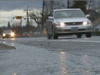
Salem-News.comUse extreme caution when traveling in today's stormy weather.
 File photo by Tim King Salem-News.com |
(SALEM, Ore.) - Slides, fallen trees and high water have closed or are partially blocking several highways in NW Oregon. The length of closures and when the highways can be reopened are unknown at this time. Motorists are advised to avoid these areas.
You can also check out our brand new road conditions report which launched Sunday. The link is located on the left side of the front page, here is a shortcut for now: Oregon Road Conditions
As of 10:20 AM Monday:
- U.S. 20 has an estimated delay of 20 minutes to two hours from mileposts 1-14 because of downed trees
- U.S. 26 (Sunset Highway) is closed from Staley's Junction (milepost 47, at the junction with Oregon 47) to Seaside (milepost 2) due to high winds, downed trees and power lines
- U.S. 30 (Lower Columbia River Highway) is closed in several locations: o from the west end of Clatskanie (milepost 62) to the Columbia/Clatsop county line (milepost 70) due to downed trees, a small slide, and high water o in downtown St. Helens due to a mudslide crossing the highway o from milepost 80 to 92 (Astoria city limits begin at milepost 94)
- U.S. 101 (Pacific Coast Highway) is closed in several locations: o at milepost 1.5, just of south Astoria, due to severe weather and down trees o between mileposts 21 and 23, just south of Seaside, because of high water on the highway o at milepost 64 (just north of Tillamook) because of downed power lines and high water between Latimer Road and Wilson River Loop o at milepost 125 due to a down tree blocking the highway o at milepost 158 due to low-hanging power lines
- Oregon 6 (Wilson River Highway) is closed from Banks to Tillamook (milepost 49 to milepost 2) due to downed trees. In addition, the Oregon Department of Forestry has activated the "Debris Flow Warning System" for Oregon 6 (mileposts 5 to 39—Timber Road); a debris flow warning means that dangerous, rapidly-moving landslides are very likely. Travelers in this area may be in imminent threat of serious injury and should take immediate precautions.
- Oregon 18 is closed between mileposts 1 and 17 because of multiple downed trees
- Oregon 22 is closed at two locations: six miles west of the intersection with OR 18 because a tree is blocking the road, and at milepost 19 (Three Rivers) due to downed trees
- Oregon 34 is partially blocked (one lane) near Alsea Mountain due to a slide
- Oregon 53 is closed due to downed trees
- Oregon 131 is closed due to downed trees
- Oregon 153 is closed at milepost 1, about one mile east of OR 18, due to high water
- Oregon 180 is closed between Eddyville and Blodgett due to trees across power lines
- Oregon 202 is closed at its intersection with 8th in Astoria, just east of Old Youngs Bay Bridge, after a vehicle crashed into a power pole
- Oregon 240 is closed between Newberg and Yamhill due to high water
Salem-News Weather Related Links: Seven day weather forecast | Weather Stories | Road Conditions | Road Cameras
Articles for December 2, 2007 | Articles for December 3, 2007 | Articles for December 4, 2007


Support
Salem-News.com:
Salem-News.com:


Contact: adsales@salem-news.com | Copyright © 2026 Salem-News.com | news tips & press releases: newsroom@salem-news.com.
Terms of Service | Privacy Policy
Terms of Service | Privacy Policy
All comments and messages are approved by people and self promotional links or unacceptable comments are denied.
[Return to Top]
©2026 Salem-News.com. All opinions expressed in this article are those of the author and do not necessarily reflect those of Salem-News.com.